

Übernachtung mit Frühstück - Le Grand Jardin d'Elisabeth
Zwischen Luberon und Durance am Fuße des alten Dorfes Lauris empfängt Sie Elisabeth in einer idyllischen Umgebung. Ein idealer Ort, um nach einer Radtour zu Atem zu kommen.


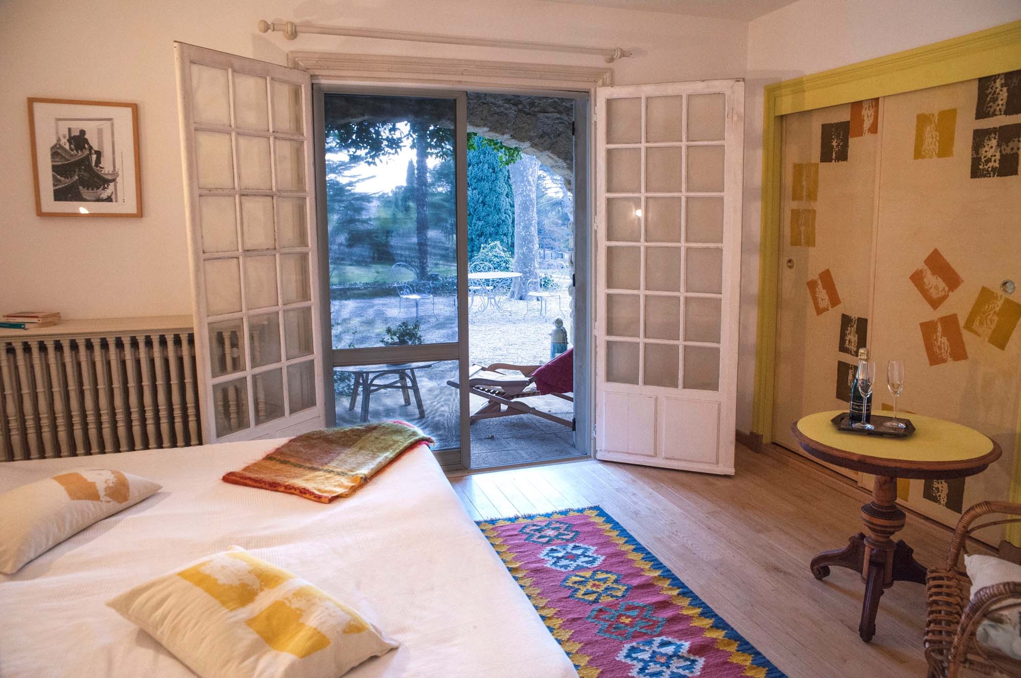
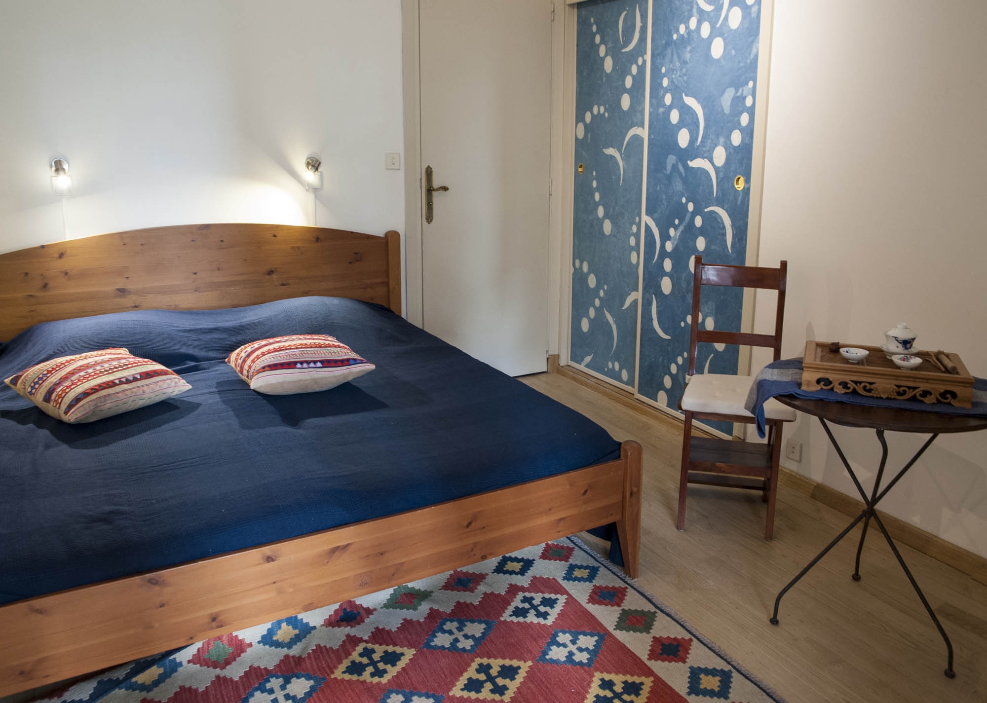
Zwei geräumige Zimmer im Erdgeschoss eines gut renovierten Hauses aus den 70er Jahren mit Ecogite-Qualifikation, Zugang zur Terrasse und zum Park.
Jedes Zimmer ist ausgestattet mit:
- ein Doppelbett von 1,80 x 2 m,
- ein Kleiderschrank,
- Sessel,
- ein kleiner Tisch und hat ein eigenes Bad.
Die Dekoration wurde von lokalen Künstlern gemacht.
Die Zimmer verfügen über einen unabhängigen Zugang durch ein großes Wohn-/Esszimmer mit einem TV, einem Kühlschrank und den für die Zubereitung von Tee, Kaffee oder einer leichten Mahlzeit erforderlichen.
Für die Sicherheit Ihrer Fahrräder steht Ihnen eine geschlossene Garage zur Verfügung.
Das Frühstück wird nach Ihren Wünschen und Bedürfnissen von Produkten aus lokalem biologischem Anbau zusammengestellt.
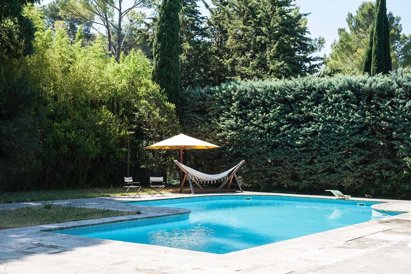
Im Sommer erwarten Sie Sonnenliegen und Hängematten, um bequem neben dem großen Familienpool (18 x 10 m) zu sitzen, der durch eine Alarmanlage gesichert und mit einer Solardusche und einem Sprungbrett ausgestattet ist.
Kleine Kinder können sich im kleinen Pool nebenan sicher amüsieren. Eine Tischtennisplatte ist während Ihres Aufenthalts ebenfalls verfügbar.
Es werden Pflückreisen und Verkostungsworkshops mit essbaren Wildpflanzen angeboten.
Eine Töpferwerkstatt vor Ort und ein Permakulturgarten sind Teil dieses schönen Bed & Breakfast.
Fotogalerie


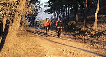
GTV VTT Etape 8 - De Vitrolles-en-Luberon à Lauris
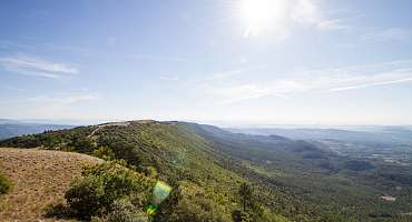
Rund um den Mourre Nègre, dem höchsten Punkt des Luberon NRP, ist diese Strecke ein Genuss für diejenigen, die über den Körperbau und die Technik verfügen, um sie zu schätzen.
Siehe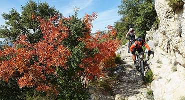
GTV VTT Etape 9 - De Lauris à Mérindol
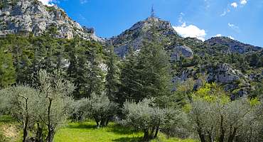
Die Route durchdringt die zerrissenen Flanken der Südwand von Petit Luberon und steigt steil zum majestätischen Panorama der Portalas und des geheimnisvollen Zedernwaldes an.
Siehe
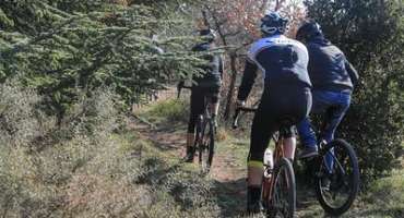
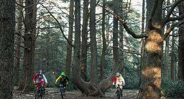
Circuit VTT n°49 - Forêt des Cèdres du Petit Luberon
Entdecken Sie diese Mountainbike-Strecke im Herzen des Zedernwaldes auf den Höhen von Bonnieux! Eine einfache Route, mit der Sie das Petit Luberon Massiv durchqueren können.
Siehe
Autour du Luberon à vélo
Eine Radtour für Liebhaber des Wanderns um das Luberon-Massiv. In beide Richtungen ausgeschildert, durchqueren Sie die Landschaften und typischen Dörfer der Provence.
Siehe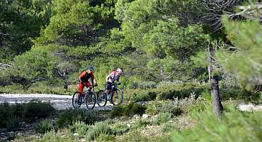
Circuit VTT n°36 - Peyre Plate
Von Mérindol aus führt Sie diese wunderschöne kleine Mountainbike-Tour am Fuße der Südwand von Petit Luberon zwischen Buschlandhügeln und hügeligen Kämmen.
Siehe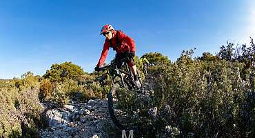
Circuit VTT n°35 - Forêt des Cèdres et Tour Philippe
Eine wunderschöne Mountainbike-Route, die die Große Überquerung von Vaucluse an den Süd- und Nordhängen zwischen Lauris und Bonnieux, zwei emblematischen Dörfern des Territoriums, führt.
Siehe
Le Pays d'Aigues à vélo
Radeln Sie durch die Weingüter sowie die mittelalterlichen Städte zwischen dem Luberon-Massiv und der Durance, um das gesamte Erbe von South Luberon zu entdecken.
Siehe
Parcours n°25 - Lourmarin
Privilegierte Route zwischen den mythischen Dörfern von South Luberon. Radtour für einen besseren Besuch der Provence und des Pays d'Aigues. Ideale Aktivität für Ihren Urlaub.
Siehe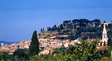
Parcours n°26 - Mérindol
Eine Radtour durch das Durance-Tal am Fuße des Luberon und für alle zugänglich. einschließlich der Dörfer Mérindol und Lauris.
Siehe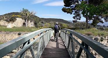
Circuit VTT n°33 - Colline des Gardis
Entdecken Sie eine kleine Mountainbike-Schleife, die sehr angenehm zu fahren ist, zwischen Cadenet, seiner feudalen Burg und einem Blick auf die Durance und das schöne Dorf Lourmarin.
Siehe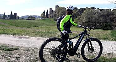
Circuit VTT n°34 - Entre villages perchés
Diese eher rollende Schleife startet in Lourmarin, das als eines der schönsten Dörfer Frankreichs gilt, und führt die Mountainbike-Strecke Nr. 33 nach Cadenet.
SieheContact & informations
Übernachtung mit Frühstück - Le Grand Jardin d'Elisabeth
95 avenue de la Gare
84360 Lauris
Telefon
E-Mail-Adresse
Website
Zu Favoriten hinzufügen
Entdecken Sie unser kostenloses und leicht zugängliches Tool, mit dem Sie Ihre Fahrradroute mit wenigen Klicks erstellen können!
Erstellen Sie Ihre Fahrradroute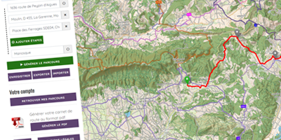


Unterlagen anfordern
Entdecken Sie unsere Broschüren und Faltblätter, um Ihren Aufenthalt mit dem Fahrrad vorzubereiten: Strecken, Dienstleister, Terminkalender...
Bestellen Sie