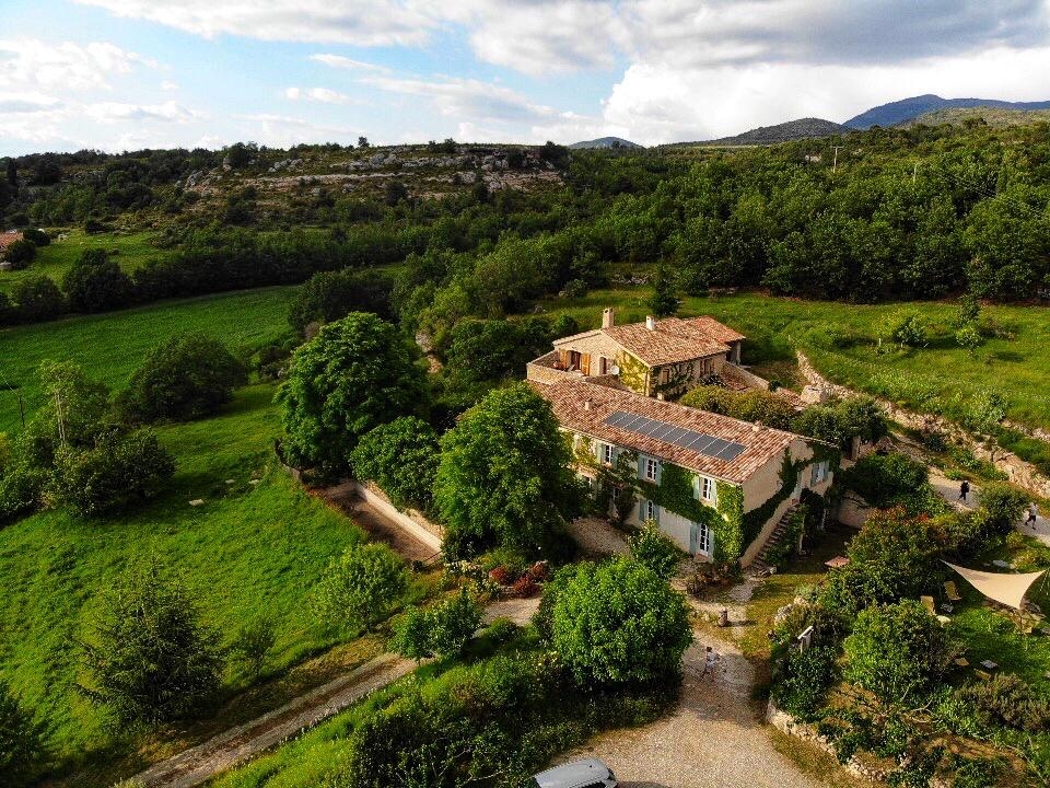
Übernachtung mit Frühstück - La Ferme du Petit Ségriès
Übernachten Sie in den Zimmern von La Ferme du Petit Ségriès, einem einzigartigen Ort für Liebhaber der freien Natur und idealer Ausgangspunkt für Radtouren!


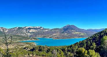
5 km vom Dorf Moustiers-Sainte-Marie entfernt, an den Ausläufern von Montdenier und mit Blick auf den See Sainte-Croix, heißt Sylvie Sie in ihrem typischen Bauernhof der Region willkommen.
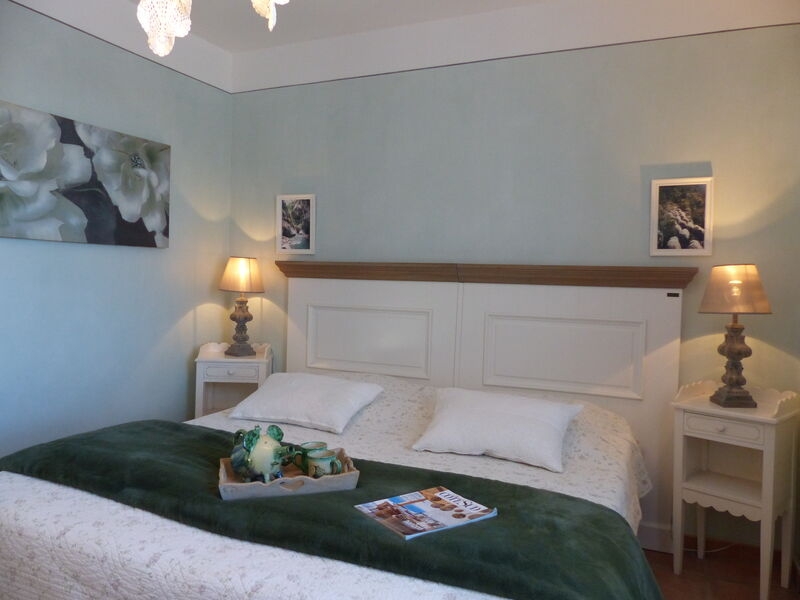
La Ferme du Petit Ségriès bietet Ihnen die Möglichkeit, in Zimmern zu übernachten und den Table d'hôte in einer entspannten Umgebung und einer warmen Atmosphäre zu genießen.
Die fünf Zimmer sind mit „Gîte de France“ und „Marque Parc“ gekennzeichnet.
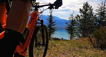
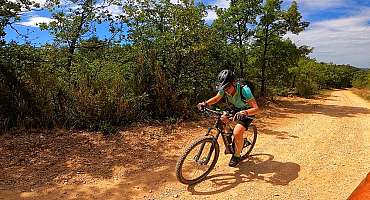
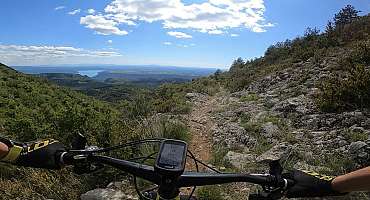
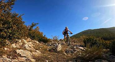
Von der Farm aus steht Ihnen eine große Auswahl an Radwegen zur Verfügung: Entdeckungsrouten in den Lavendelfeldern, Sport- und technische Mountainbike-Strecken oder Touristenrouten) mit dem Fahrrad mit elektrischer Unterstützung oder nicht.
Fahrradfreunde nutzen auch die Dienstleistungen, die Ihnen zur Verfügung stehen, um ein unvergessliches Erlebnis im Verdon zu erleben (sicherer Fahrradraum, Bereitstellung von Fahrrad- und Mountainbike-Karten, angepasste Beratung...)!
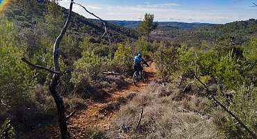
Fotogalerie


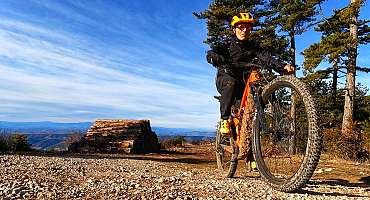
Provence Verdon MTB-FFC Bereich - Reiseroute 3: Die Grand Tour
Entdecken Sie die Mountainbike-Rennstrecke Nr. 3 - Black - Die Grand Tour durch die MTB-FFC Provence Verdon. Genießen Sie die Haut-Var-Plateaus und das Valensole-Plateau.
Siehe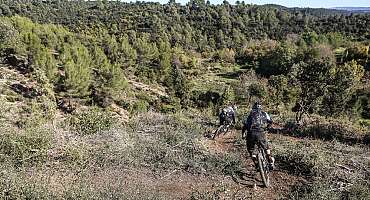
MTB-FFC Provence Verdon Bereich - Reiseroute 5
Entdecken Sie die Mountainbike-Rennstrecke Nr. 5 - Red des MTB-FFC Provence Verdon. Genießen Sie viele Aussichtspunkte auf den Hochebenen von Haut Var und Valensole.
Siehe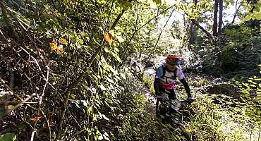
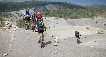
MTB-FFC Provence Verdon Bereich - Route 22
Entdecken Sie die Mountainbike-Rennstrecke Nr. 22 - Bleu des MTB-FFC-Gebietes Provence Verdon. Genießen Sie zahlreiche Aussichtspunkte entlang der Route.
Siehe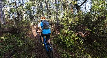
MTB-FFC Provence Verdon - Reiseroute 4
Entdecken Sie die Mountainbike-Rennstrecke Nr. 4 - blau der MTB-FFC Provence Verdon. Ausgehend von den Gemeinden Riez und Roumoules genießen Sie viele Aussichtspunkte.
Siehe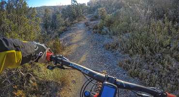
MTB-FFC Provence Verdon - Reiseroute 4
Entdecken Sie die Mountainbike-Rennstrecke Nr. 4 - Bleu der MTB-FFC Provence Verdon. Steigen Sie in den Sattel und fahren Sie 15 km im Verdon!
Siehe
MTB-FFC Provence Verdon Bereich - Reiseroute 5
Entdecken Sie die Mountainbike-Rennstrecke Nr. 5 - Red des MTB-FFC Provence Verdon. Genießen Sie viele Aussichtspunkte auf den Hochebenen von Haut Var und Valensole.
Siehe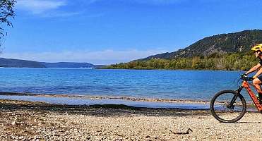

Tour du Verdon à vélo
Liebhaber von Roaming und Abenteuer können die Tour du Verdon mit dem Fahrrad fahren! Reisen Sie in einem einzigartigen Gebiet: weite Freiflächen, atemberaubende Panoramen und emblematische Dörfer.
Siehe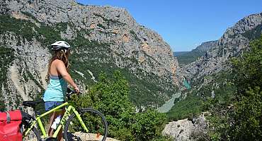
Grand Canyon
Abenteuer von den Tiefen der Gorges du Verdon bis zur Crêtes-Straße und ihren vielen Aussichtspunkten, Radweg von Moustiers-Sainte-Marie nach La Palud-sur-Verdon.
Siehe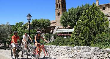
La Romaine
Sportliche Freizeit in Verdon, Radtour auf der Suche nach der reichen territorialen Vergangenheit durch die Überreste von Epochen. Reise in die Geschichte der Provence.
Siehe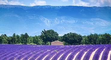
Plateau de Valensole
Freizeitradroute für eine gemütliche Radtour im Rhythmus der Natur und Lavendel- oder Getreidefelder auf dem Valensole-Plateau.
SieheContact & informations
Übernachtung mit Frühstück - La Ferme du Petit Ségriès
Le Petit Ségriès
30 Chemin de Vénascle
04360 Moustiers-Sainte-Marie
Telefon
E-Mail-Adresse
Website
Zu Favoriten hinzufügen
Entdecken Sie unser kostenloses und leicht zugängliches Tool, mit dem Sie Ihre Fahrradroute mit wenigen Klicks erstellen können!
Erstellen Sie Ihre Fahrradroute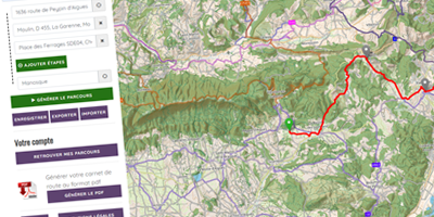


Unterlagen anfordern
Entdecken Sie unsere Broschüren und Faltblätter, um Ihren Aufenthalt mit dem Fahrrad vorzubereiten: Strecken, Dienstleister, Terminkalender...
Bestellen Sie